Hurricane-force winds and massive 50-Foot seas have been generated by the most intense storm this season on the North Atlantic that has posed dangerous conditions for shipping.
Extreme intensification of the wind field and rapid central pressure drop follow the intrusion of the frigid cold air mass from the Northeast U.S. and Eastern Canada, reports the severe-weather.eu news platform.
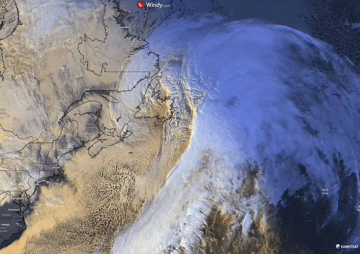
Monday evening, the intrusion of the polar air mass into the Northwest Atlantic triggered the rapid intensification of the developing low, which is now trailing northeast along Atlantic Canada.
“The final visible satellite scans before nightfall revealed an impressive yet textbook cyclonic structure of a rapidly deepening low. The central pressure has been falling by more than 5 mbar per hour, as observed at weather stations across Newfoundland,” the report noted before adding: “The disruption of the Polar Vortex that resulted in its split across the Northern Hemisphere, sending frigid cold Arctic outbreaks from Canada into the North Atlantic. Triggering violent mid-latitude cyclone, emerging off the eastern North America and traveling towards Europe. A violent 930 mbar low is near Newfoundland and continues to develop explosively on Tuesday.”
For its part, the Ocean Prediction Center in Washington has issued heavy freezing spray warnings for vessels operating in the region. Moderate to heavy freezing spray conditions are foreseen within the Gulf of Saint Lawrence and along portions of the Canadian coast, with light to moderate freezing spray extending across a wider area including waters off Greenland.
Weather forecasters expect the system to continue moving northeast and just weaken slowly over the next 24 hours.
(Image from EUMETSAT)